Chances are you using Google Maps for all your navigation needs. Why shouldn't you?
Once upon a time I had to provide my modem to a Comcast representative
so that they could disconnect it from my account. I looked up the nearest
Comcast location and embarked on a journey. The Google Maps pin was pointing to a
non-residential building, so I blindly trusted Google to guide me to the
correct location. Upon arriving at the building under a light rain, I was
surprised to find out it was actually a public pool/Department of Conservation
and Recreation (DCR) office. I wasn't the first one to get there by mistake, so I
was redirected to the end of the road, just a couple blocks away.
Please note that I did not own a car, and no buses were going that route, so
a couple of blocks away (half a mile, 800m) turned into a 20 minute walk under
what turned to be an umbrella-bending thunderstorm.
Having returned home, I decided to notify Google of the wrong marker
location. I sent a request explaining the issue. A few days later I
received the notification that my case was closed and no action taken since not
enough proof was provided. I tried the second time, but something did not work
quite right then either.
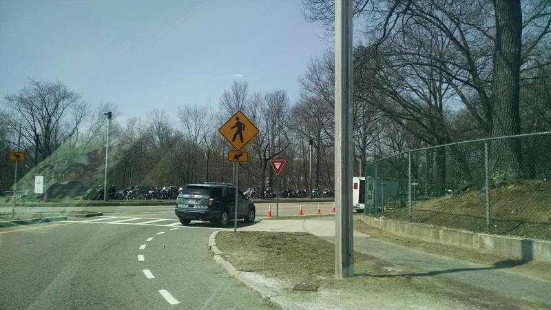
Since I started driving, I've missed a number of turns because the map did not
match what was on the ground, Google Maps would announce "Arrived" when
my destination entrance was concealed by the trees and there was a whole parking lot
between us, we've been guided through that Casey Overpass WIP site where left
turn is a suicide because you don't see oncoming traffic. I started to care
deeply about those things, but I can't influence a corporation to care about a
small misplaced road.
So now I fix things myself. And when a number of naviqgation
applications pick these changes up, I can benefit from having an accurate map at
my disposal.
So the first application I downloaded related to OpenStreetMap was OsmAnd.
OpenStreetMap is highly addictive. You think you start with fixing the data for your neighborhood and a couple of days later you are modifying routing configuration on a major highway. You've been warned.
I've gone crazy. For almost two months I did not read any of my RSS feeds, I stopped posting much to diaspora/twitter, I bought a rangefinder, began to look suspicious, and talked to a lot of people.
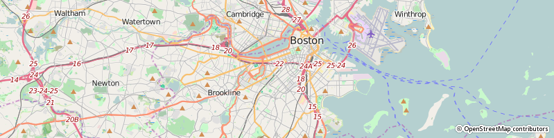
In the end of April 2016, we moved from Boston (MA) to Farmington Hills (MI)
for work reasons. I wanted to take my potted flowers with me, so flying was
not a suitable option, and that's when a crazy idea came to mind: what if we
drive? The distance between the cities is around 840 miles (we could only go
through US), so covering it in two days seemed reasonable.
We had broken the route down into 7 parts (3 on the first day and 4 on the
second), added some buffer (although not a lot) and hoped for the best.
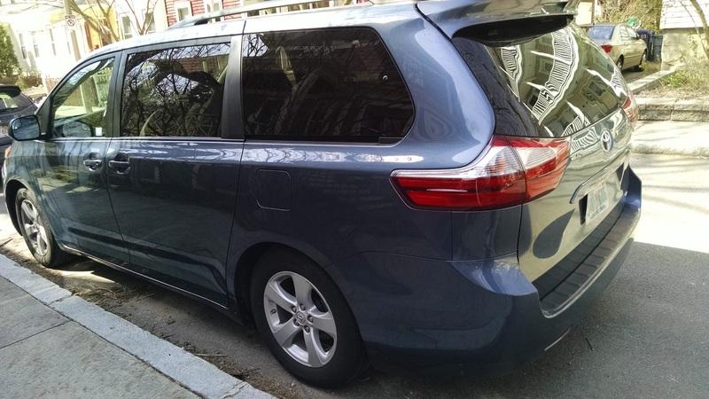
Unfortunately, when packing our things into the moving container, we faced a
problem: two large pieces of furniture – the wardrobe and the dresser – did
not fit, so we had to find ways to get rid of them. This took several hours
away from our packing time, and as a result, we were not rested enough on the
morning of departure (especially Roman). Eventually, we were lucky to get a
huge car that fit the dresser (yay!), but we left Boston two hours later than
we had planned.
The huge car (Toyota Sienna)
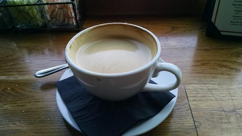
The last cup of coffee in Boston (Simpli Bar & Bites)
Our planned intermediate stops were cafes and gas stations.
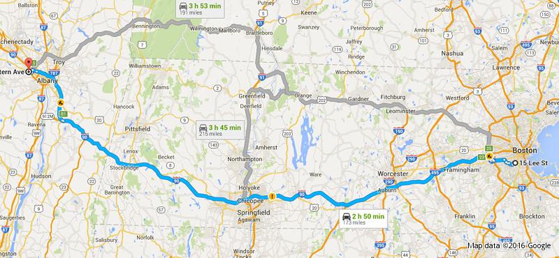
First leg: Boston MA – Albany NY (173 miles)
Planned time: 10AM - ~1PM
Actual time: 12PM – 3:10PM
Biker parade (?) when leaving Boston
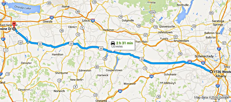
Second leg: Albany NY – Syracuse NY (120 miles)
Planned time: ~2PM - ~5PM
Actual time: 4:39PM – 7:35PM
This part we decided to cover by smaller roads so that the drive is less
monotonous and more scenic.
When we got to Syracuse area, Roman was already very sleepy and tired from the
sun shining into his face, so we decided it's safer and wiser to spend the
night there and deal with the lost time the next day. So we canceled our motel
in Buffalo and headed to a Hilton in East Syracuse.
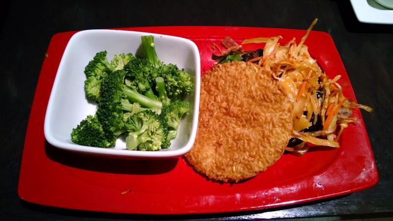
A Red Robin special burger with buns made of ramen – tasty but quite messy
The second day was much more productive.
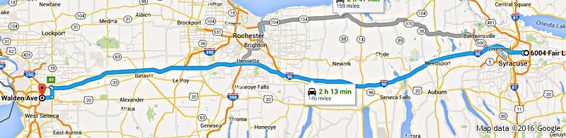
Third leg: Syracuse NY – Buffalo NY (146 miles)
Planned time: ~6PM previous day - ~9PM previous day
Actual time: 10:15AM – 12:50PM
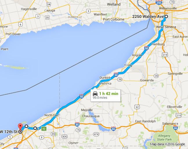
Fourth leg: Buffalo NY – Erie PA (105 miles)
Planned time: ~10AM - ~1PM
Actual time: 1:40PM – 4:35PM
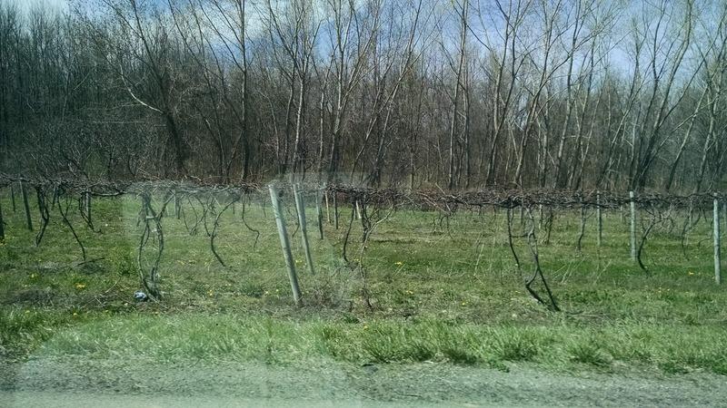
Turns out there are a lot of vineyards in New York and Pennsylvania
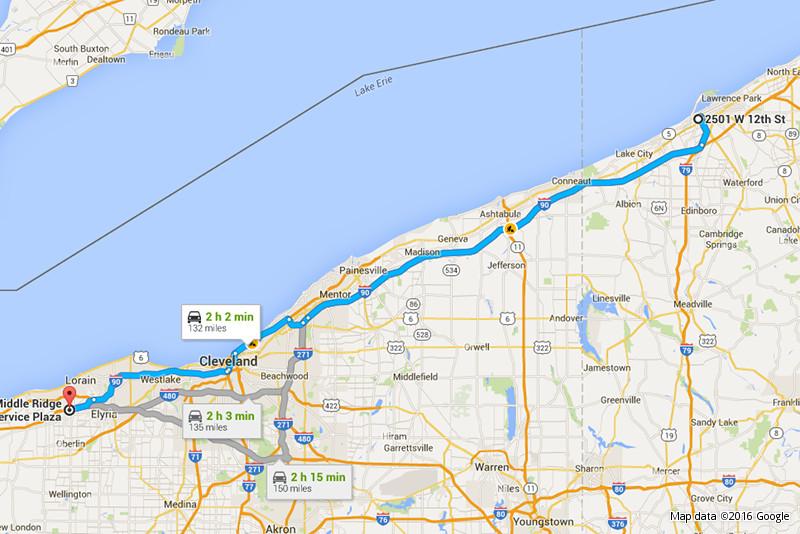
When we arrived in Erie, we had to decide whether we are going to stop in a
hotel once more or make an effort and arrive in Farmington Hills the same day.
Roman was in an optimistic mood, so we decided to make the last stop at a toll
road service plaza instead of a cafe to save time. Our original plan included
stops in Cleveland and Toledo instead, so there was no planned time for this
modified leg.
Fifth leg: Erie PA – Amherst OH (132 miles)
Actual time: 6PM – 8:14PM
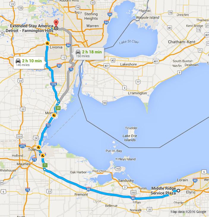
Sixth leg: Amherst OH – Farmington Hills MI (146 miles)
Actual time: 8:55PM – 11:25PM
Total distance: 822 miles
Total time driving: 10 hours 20 minutes
Our original planned arrival time was ~9PM, so we did pretty well in general,
there was very little traffic even with all the road work. We did learn several
things though:
Buffer for stops should be bigger, especially if they are not counter-serve cafes.
Not getting enough sleep and being dressed too warmly has a big impact on the driver's endurance.
Stops every 2-3 hours make the trip far more pleasant than with longer intervals.
Not all the gas stations that are on a map actually exist :-)
Fuel in Massachusetts is cheaper than in other states that we passed. Or was cheaper, anyway.
My lp:rye/duplicity/mediafire branch was merged. And this means that MediaFire
backend will be available for general public when the next duplicity version
is released.
I had to change a couple of things in order for it to be accepted, so here's
how to use the new built-in mediafire backend.
All the warnings from my original article still stand, so read that first
before you sign up for the service.
When you buy a physical book, you don't sign an agreement dictating the
conditions which you must satisfy to read it. That would be crazy, right? You
expect to be able to read it anywhere you like. You can read it on the bus,
you can read it in the park. Heck, you can even take it to the shower and read
it, damaging the pages, but it is your book, you paid money for it and you can
do whatever you want.
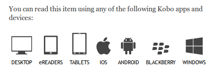
If you buy an ebook from a major store (Amazon, Kobo), chances are you are
getting something extra with your book.
Looks like it covers everything, right?
If you have a supported platform, everything magically works, and you don't
think about buying the next book much. If you, like me, have GNU/Linux as your
only OS, then your purchased book basically turns into a digital paperweight.
Instead of owning the book, you merely own a license to read the book and
only a set of approved readers will allow you to actually
read it. The class of systems that impose these restrictions is called DRM,
after Digital Rights Management. And you have very little rights there.